

Manaslu Region, Travel Guide - September 26, 2026
Larkya La Pass Trek: Complete Guide
Table of Contents
No headings found in this article.
Larkya La Pass is one of the most challenging and rewarding sections of the Manaslu Circuit Trek in Nepal. Rising to approximately 5,106 meters (16,752 feet), it connects the Budhi Gandaki Valley with the Marsyangdi Valley. Trekkers reach the crossing after several days of gradual ascent through forests, traditional villages, alpine landscapes, glaciers, and rugged Himalayan terrain.
The crossing requires good preparation because of the high elevation, steep terrain, cold temperatures, unpredictable weather, and long trekking day. However, proper acclimatization, suitable equipment, physical preparation, and a steady pace can make the journey more manageable.
This guide covers the difficulty, route, distance, elevation, weather, permits, preparation, acclimatization, and safety considerations for trekkers planning the Manaslu Circuit.
Highlights of Larkya La Pass
- Samagaun (3,530 m): A beautiful mountain village with traditional Tibetan-influenced culture and impressive views of Manaslu.
- Pungyen Gompa (around 3,900–4,000 m): A peaceful Buddhist monastery surrounded by dramatic mountain scenery.
- Manaslu Base Camp (around 4,800 m): A spectacular side trip from Samagaun with close views of Manaslu, glaciers, and surrounding peaks.
- Samdo (around 3,860 m): The last permanent village settlement before the high pass, known for its traditional Himalayan lifestyle and Tibetan cultural influence.
- Larkya La Pass (5,106 m): The highest point of the Manaslu Circuit, offering wide views of the surrounding Himalayan ranges.
- Mountain views: Can see Manaslu, Himalchuli, Ngadi Chuli (Peak 29), Cheo Himal, Kang Guru, Annapurna II, and other surrounding peaks.
- Himalayan culture: Experience Buddhist monasteries, prayer flags, mani walls, chortens, traditional stone houses, and the Tibetan-influenced lifestyle of the local communities.
- Bhimtang descent: After crossing the pass, the landscape gradually changes as the trail descends toward Bhimtang (3,590 m), with forests and greener mountain valleys appearing again.
Location and Elevation
The pass lies in the Manaslu region of north-central Nepal and forms the highest point of the Manaslu Circuit Trek.
At approximately 5,106 meters (16,752 feet) above sea level, the area has considerably less oxygen than lower elevations. Trekkers therefore need adequate acclimatization before attempting the crossing.
The surrounding landscape features dramatic Himalayan peaks, glacial valleys, rocky slopes, snow-covered terrain, and expansive mountain views. The combination of altitude, weather, and remote terrain makes this one of the major challenges of the trek.
History and Significance
Larkya La has long served as a high Himalayan crossing between the valleys surrounding the Manaslu region. Mountain communities have traditionally relied on these trails for travel, trade, and communication between settlements.
Today, reaching the top represents a major milestone for trekkers completing the Manaslu Circuit. The crossing also provides spectacular views of the surrounding Himalayan landscape.
Larkya La Pass Difficulty: How Hard Is It?
Crossing Larkya La Pass (5,106 m / 16,752 ft) is one of the most challenging days of the Manaslu Circuit Trek. The trek from Dharmasala to the pass and then down to Bhimtang is long, with steep sections, cold temperatures, and potentially snowy or icy trails.
The high altitude and thin air can make the climb physically demanding, especially for trekkers who are not used to walking at high elevations. Weather and trail conditions can also affect the difficulty.
For reasonably fit trekkers who have acclimatized properly, the crossing is challenging but achievable. Start early, maintain a slow and steady pace, take regular breaks, and stay hydrated. Allow plenty of time for the ascent and long descent.
If you experience serious symptoms of altitude sickness, do not continue toward the pass. Your safety should come first, and descending to a lower elevation is the appropriate response.
Route and Distance
Dharamsala, also known as Larkya Phedi, is the last main teahouse and overnight settlement before the pass crossing. Trekkers usually stay here overnight and start early the next morning for the challenging ascent.
From Dharamsala (4,460 m / 14,633 ft), the trail climbs steadily through rugged high-altitude terrain for approximately 7 km. It generally takes around 5–6 hours to reach the top, depending on your pace, weather, trail conditions, and rest breaks.
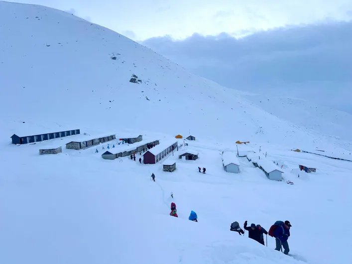
Snow-covered Dharmasala (4460 m ), the last tea house before Larkya La Pass.
After reaching the pass, the trail descends toward Bhimtang (3,590 m / 11,778 ft). This section covers approximately 8.5 km and takes around 4–5 hours. Much of the route consists of downhill terrain, although the descent can still be demanding because of the steep and rocky trail.
Overall, the journey from Dharamsala to Larkya La Pass and then to Bhimtang is a long and challenging trekking day, covering approximately 15.5 km in total. Starting early is a smart choice because it gives trekkers enough time to complete both the ascent and descent at a comfortable pace.
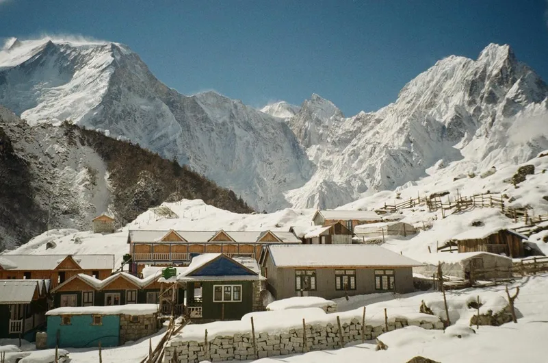
Bhimdhang Village 3,590 m (11,778 ft)
Natural Beauty
The high-altitude landscape provides some of the most dramatic scenery on the Manaslu Circuit. As the trail climbs higher, vegetation becomes sparse and the landscape changes from forests and villages to rugged alpine terrain.
Trekkers can experience:
- Snow-covered Himalayan peaks
- Glacial valleys
- Rocky mountain slopes
- High mountain ridges
- Snow and ice during colder seasons
- Expansive Himalayan views
The changing landscape makes the approach particularly memorable. Lower sections feature forests, rivers, and traditional villages, while the upper terrain becomes increasingly dominated by rock, snow, glaciers, and mountain ridges.
Larkya La Pass and the Manaslu Circuit Trek
The crossing is a major part of the Short Manaslu Circuit Trek, rather than another name for the entire trek. It represents the highest and one of the most demanding sections of the route.
The Manaslu Base Camp Trek and Short Manaslu Circuit Trek share the same main route up to Samagaun. From Samagaun, trekkers can take a side trip to Manaslu Base Camp before returning to the main trail. The route then continues toward Samdo and Dharamsala.
The main difference between the itineraries is the additional Manaslu Base Camp side trip from Samagaun. Trekkers can return from Base Camp to the main trail and continue toward Dharamsala before completing the high-altitude crossing.
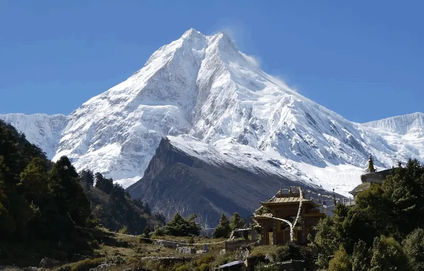
Majestic Mount Manaslu (8,163 m / 26,781 ft), the eighth-highest mountain in the world.
Required Permits for the Manaslu Circuit Trek
The Manaslu Circuit Trek passes through a restricted trekking area, so foreign trekkers need several permits before starting the journey. The trek also requires trekkers to travel with a licensed trekking guide and arrange the necessary permits through a registered trekking agency in Nepal.
The main permits and requirements include:
- Manaslu Restricted Area Permit (RAP): Required for the restricted section of the Manaslu region. The permit must be arranged through a registered trekking agency before entering the restricted area.
- Manaslu Conservation Area Permit (MCAP): Required for trekking within the Manaslu Conservation Area.
- Annapurna Conservation Area Permit (ACAP): Required for the section of the route that enters the Annapurna Conservation Area after crossing toward Dharapani.
- Chumnubri Rural Municipality Fee: A local government fee is required for the Manaslu restricted area within Chumnubri Rural Municipality.
- TIMS Card: Trekkers on the Manaslu Circuit must follow the current TIMS requirements, which include traveling with a licensed guide and obtaining the TIMS through a registered trekking agency.
Compulsory Guide and Trekking Agency
The Manaslu Circuit is a restricted trekking route, so independent trekking is not permitted for foreign visitors under the current regulations. Trekkers must be accompanied by a licensed trekking guide and arrange the required documentation through a registered trekking company in Nepal.
Your trekking agency normally handles the permit application, TIMS, guide arrangements, and other required documentation before you enter the Manaslu region. This makes the permit process easier and ensures that your trek follows the current regulations.
Because permit requirements, fees, and regulations can change, trekkers should confirm the latest information with their registered trekking agency before starting the trek.
Best Time to Do
The best trekking seasons generally provide more stable weather, clearer mountain views, and better trail conditions.
Spring, from March to May, offers favorable trekking conditions and increasingly warmer temperatures.
Autumn, particularly October and November, is another popular period because stable weather often provides clear mountain views.
Winter brings much colder temperatures and a greater possibility of snow and ice. Heavy snowfall can make the crossing difficult or temporarily inaccessible.
The summer monsoon can also create challenges, particularly on the lower sections of the Manaslu Circuit, where heavy rainfall can affect trails and transportation.

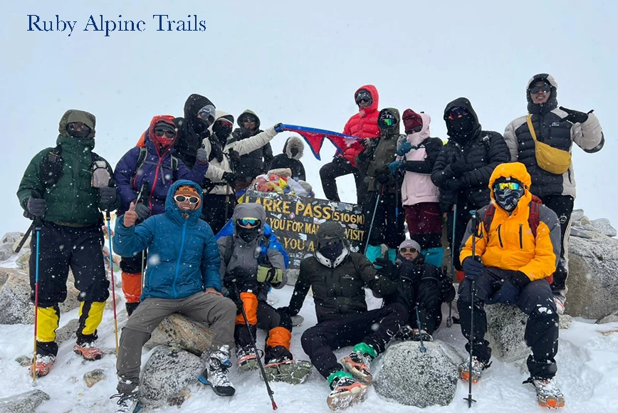
Celebrating at Larkya La Pass (5,106 m), with stunning Himalayan views and Larke Peak in the background.
Preparation Tips
Good preparation can make the trek considerably more manageable. Start training several weeks before departure rather than relying only on fitness developed during the journey.
Focus on:
- Building cardiovascular endurance
- Strengthening your legs and core
- Practicing long uphill walks
- Hiking with a backpack
- Breaking in your trekking boots
- Learning about altitude sickness
- Preparing suitable cold-weather clothing
- Carrying enough water and snacks
- Keeping your itinerary flexible
Mental preparation also matters. The crossing can involve cold temperatures, fatigue, strong winds, thin air, and slow progress. A steady pace helps you conserve energy.
What to Pack for the Larkye La Pass-Crossing Day
The pass-crossing day is long, cold, and demanding, so it is important to carry only the essentials in your daypack. Since you start early from Dharamsala and later descend toward Bhimtang, prepare for both freezing temperatures and warmer conditions at lower elevations.
- Warm down jacket : Essential for the cold morning and high altitude.
- Thermal base layers : Keep your body warm during the early ascent.
- Fleece or insulating layer : Useful as temperatures change throughout the day.
- Waterproof and windproof jacket : Protects you from wind, snow, and sudden weather changes.
- Warm gloves and hat : Important because your hands and head can lose heat quickly.
- Good trekking boots : Choose comfortable, broken-in, and preferably waterproof boots with good grip.
- Trekking poles : Particularly useful on the steep ascent and long descent.
- Water and electrolytes : Carry enough water and consider an electrolyte drink for the long trekking day.
- Energy snacks : Chocolate, energy bars, nuts, dried fruit, or other easy-to-carry foods can provide quick energy.
- Sunglasses and sunscreen : Protect your eyes and skin from strong sunlight and snow glare.
- Headlamp : Essential because you normally start before sunrise.
- Basic first-aid kit and personal medication : Carry any essential medicines along with basic first-aid supplies.
- Waterproof backpack cover or dry bags : Keep clothing and electronics protected from snow or rain.
- Phone, power bank, and camera : Useful for communication, navigation, and capturing the mountain scenery.
Tip: Avoid overloading your daypack. Keep frequently needed items such as gloves, water, snacks, sunglasses, and an extra layer easily accessible. Starting early from Dharamsala is a smart choice, so have your backpack prepared the night before.
Acclimatization Strategies
Proper acclimatization plays a central role in a successful crossing. Your body needs time to adjust as you gain elevation.
A sensible itinerary should include gradual elevation gains and appropriate rest opportunities. Avoid gaining altitude too quickly and pay attention to how your body responds.
Useful strategies include:
- Walk at a slow and comfortable pace.
- Stay adequately hydrated.
- Eat regular and nutritious meals.
- Avoid alcohol at high altitude.
- Take appropriate rest days.
- Monitor yourself and fellow trekkers for altitude-sickness symptoms.
- Descend if serious symptoms develop.
Physical fitness does not replace acclimatization. Even experienced trekkers can experience altitude-related problems.
Physical and Mental Preparation
Physical preparation should focus on endurance rather than maximum strength. Long uphill walks, stair climbing, hiking, cycling, and similar aerobic activities can prepare your body for the demands of the trek.
Strength exercises such as squats, lunges, step-ups, and core workouts can also help your legs handle steep climbs and long descents.
Mental preparation matters as well. Accepting a slower pace can help you conserve energy and remain focused throughout the crossing.
Safety Tips
Safety should remain the top priority. Start early enough to allow sufficient time for the ascent and descent, follow your guide’s instructions, and monitor changing weather conditions.
Watch for symptoms such as:
- Persistent headache
- Nausea
- Dizziness
- Unusual tiredness
- Loss of coordination
- Confusion
- Difficulty breathing
Mild symptoms require caution, while severe or worsening symptoms can indicate a medical emergency. Descending to a lower elevation remains an important response to serious altitude sickness.
Wear appropriate layers to protect yourself from cold, wind, snow, and strong sunlight. Carry suitable gloves, a warm hat, sunglasses, sunscreen, and appropriate footwear.
What Happens If the Pass Is Closed?
Weather and trail conditions can sometimes prevent trekkers from crossing. Heavy snowfall, storms, poor visibility, or unsafe trail conditions can make the route temporarily inaccessible.
If conditions become unsafe, your guide or trekking agency may adjust the itinerary. You may need to wait for better weather or make alternative arrangements.
Never attempt to cross an unsafe route simply to stay on schedule. Mountain conditions can change quickly, so current safety conditions should determine whether the crossing goes ahead.
How Cold Does It Get?
Temperatures around the high point can fall well below freezing, particularly during the early-morning crossing. Strong winds can also make conditions feel significantly colder.
The exact temperature depends on the season, weather, wind, time of day, and elevation. Winter can bring particularly severe conditions.
The Larkya crossing is one of the major challenges of the Manaslu Circuit Trek. Its elevation above 5,000 meters, long trekking day, steep terrain, cold weather, and remote location demand careful preparation.
Proper acclimatization, physical preparation, suitable equipment, good weather judgment, and responsible pacing can make the experience safer and more enjoyable.
With the right preparation, trekkers can enjoy the dramatic mountains, glaciers, valleys, and high-altitude landscapes that make the Manaslu Circuit one of Nepal’s memorable Himalayan trekking routes.